2000 has arrived and I hope everyone had a great Christmas and
a wonderful start to the New Year (without any Y2K bugs).
to the new look hardcopy Newsletter for 2000. I decided now was
time to update the layout as there have been more and more articles
and news to be published each month. A lot has had to be left
out, or repeatedly deferred, which is not very satisfactory for
the various contributors. I did not want to put in more pages
as it makes the printing, folding and stapling harder. So, here
is the first of the editions for 2000.
Philip Hall
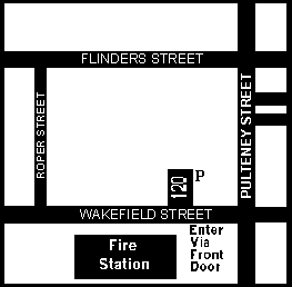
This will be held at the Conservation Centre, 120 Wakefield Street, Adelaide on Wednesday 19th January and will begin at the usual time of 8pm. (Those who have purchased a MLSSA calendar will find all the meeting dates clearly marked.)
See site map below.
Our main speaker will be David Muirhead who will be showing some more of his wonderful slides. I have had a preview and we have some beauties to view.
I say "main" as we would like other members who have
slides to bring them along as well for us to see. Every slide
will be a candidate for the Photo Index and for the 2001 calendar.
Late in 1999 Philip Hall obtained some information from the Internet about British oil spills. The information came from the British Marine Life Study Society (BMLSS). It included the following summary from a 1993 report for the Devon Wildlife Trust written by Mike Camplin:-
"Exposed sand and shingle beaches are generally self-cleaning since there are large movements of the substrate band, and because they are not biologically rich, they are best left uncleaned.
Exposed rocky shores generally have solid rock and large boulder substrates and are generally self-cleaning. In addition the animals forming the communities living there are adapted to ragged conditions in a variety of ways. They recover quickly from major damage, mostly by recruitment of new organisms from outside. They are best left uncleaned. Recovery usually takes 3-4 years.
Sheltered rocky shores are not self-cleaning habitats and are slow to recover from major damage. They may require the removal of as much oil as possible but dispersants are best avoided. Public pressure may demand a clean-up despite the damage caused. Recovery usually takes about 5-10 years.
Sheltered sands and silts are not self-cleaning and are difficult to tackle. They are biologically rich and are best protected as far as possible using booms."
"It is important that each beach should be assessed for the likely effects of large scale oil pollution, because local conditions can vary and the above statements are generalisations. There are also rare species on British shores, and some of these have slow recruitment rates."
I have prepared the following chart based on Mike Camplin's summary
information:-
| SHORE | SELF-CLEANING | COMMENTS | RECOVERY |
| EXPOSED | |||
| Sand & shingle | YES | Best left uncleaned | |
| Rocky | YES | Ditto | 3-4 years |
| SHELTERED | |||
| Rocky | NO | Remove oil, avoid dispersants | 5-10 years |
| Sands & silts | NO | Protect where possible (booms) |
Steve Reynolds
A device which monitors water quality in tuna cages and phones its information back to shore may prove to be a lifesaver for aquaculture fish stocks. The prototype, designed and built by Engineering technical staff at Flinders University, consists of a sensor probe and data logger housed within a buoy. The probe takes frequent samples of a number of variables associated with the marine environment - dissolved oxygen, turbidity and temperature, as well as salinity and pH levels. A solar-powered cellular phone is fitted to the device, enabling the collected data to be accessed from anywhere in the world.
Following initial tests at Port Stanvac, the prototype recently completed a successful six-week trial in a tuna cage off Port Lincoln.
At this stage, the logged data is retrieved by phone for analysis on shore, but ultimately the intention is to equip the probe itself with the ability to identify critical changes in water quality and to alert tuna farmers directly via a pager.
Professor Andrew Downing, Head of the School of Engineering, said the project's aim was to provide the fish farmers with a form of early warning system for protecting their stocks. Dr Jim Mitchell of the School of Biological Sciences is working with the engineers to identify the crucial factors in the marine environment that affect the well-being of the tuna. Tuna have high energy requirements, and are particularly susceptible to drops in dissolved oxygen levels associated with turbid water.
"Conditions can change drastically in a matter of hours," Professor Downing said. "If conditions, or a combination of conditions, deteriorate to a point where urgent action is needed to safeguard the health of the fish, the device could alert the farmers, giving them the opportunity to tow the tuna cage to an area where it wouldn't be susceptible to that type of problem."
A second stage of development will see weather monitoring equipment added to the device, enabling it to make observations of wind direction and speed, sunlight and air temperature. While initial support and interest has come from the tuna farmers, Professor Downing said the technology could be adapted to the needs of other forms of aquaculture such as oyster farming.
"We are expecting the device to arouse considerable commercial interest," he said.
Taken from the Flinders Journal
Volume 10, No 14 September 6 - 19, 1999
On Sunday the 23rd of September Barbara and I were up early and arrived at Screwpile by 9:30am. This was our last chance to collect weed for the show tank. When we first saw the bay at Victor Harbor, we were sure that we would be not able to see any thing under the jetty as the bay was brown from the rain during the week. Out on Screwpile we were very surprised to find that the water looked go for a change. I suppose one should expect Screwpile to be opposite to any where else because the water is always dirty when the weather has been good. While gearing up we were visited by one of the local professional fishermen, we had met him on several previous occasions. He informed us that Vixen the local school shark fishing boat, had relocated to Queens land due to the catch becoming uneconomic in our local waters. All though this must be a loss for the local economy it is a very large plus for the environment on and around the jetty. The redeployment of Vixen has meant the removal of the Diesel refuelling point from the jetty. any members will remember the large spills of diesel on the jetty and the continues leaking of the equipment even when not being used.
The day had started well and only got better. Once in the water I found that not only did the visibility look good it was the best I had ever experienced. I had only descended a couple of meters and could see the bottom clearly. Where usually you could only see the shadow of the pylons I could from one pylon to the other with ease. While collecting weed under the eastern a large Seadragon cruised by as if I was not there. This was a full grown dragon, no eggs were visible so I could not say what sex it was. As I moved on to my surprise there was another dragon just out side the line of pylons supporting the eastern ramp. This dragon was a juvenile, no more than ten centre meters long and, as with the other, it seemed not to notice I was there. Moving under the jetty to the western ramp I collected some small white anemones, at the shore end of the ramp there is what appears to be an old caterpillar track. This has all ways been there since I started to visit this site. For some reason on this dive a school o cow fish were congregating around the track. I paused and was trying to see what was attracting the cow fish when I noticed another large Seadragon just a metre beyond the school of cow fish. A closer inspection found that this was another large dragon but again there were no eggs present so I was unable to tell the sex.
It was time to head back to the eastern ramp, as I moved across to the eastern side of the jetty the things I could see that I have been under this jetty for many but I had never seen them. Back under the eastern ramp I noticed an outboard motor several meters away from the jetty. While looking over the motor I was extremely surprised to find another dragon on the other side of it. This time it was an adult Weedy Dragon.
Having over stayed the prearranged bottom time I headed back to
the ramp. While tying the catch bag and collecting bucket to the
drop line I had another visitor. A seal made a couple of passes
through the jetty. Back on the jetty I changed and told Barb of
the exceptional dive I had and all things that were to be seen.
We set off for home, arriving back at Morphett Vale at 1:00 PM.
DO
You should all have your copy of our year 2000 calendar featuring
SA marine life by now. Most of the full-colour photographs are
taken from our Photo Index of SA marine species. Many of these
Photo Index slides can also be seen on our Internet web page.
The fish on the front cover (& July's fish) is a Sharp-nosed
Weed Whiting. It is slide No.1177 in our Index. January 2000's
Six-spined Leatherjacket is slide No.1059 in the Index. The Stinging
Hydroid below it is slide 2109. February's Warty Prowfish is slide
1077. March's Roughy is slide 1138. April's Black-spotted Wrasse
is 1136 and the Southern Fiddler Ray below it is 1109. May's nudibranch
is slide No.2011. June's Western Footballer Sweep is 1073 and
the seastar below it is 2302. The ascidian colony below July's
Sharp-nosed Weed Whiting is 2203. The coral below August's Rainbow
Cale is 2108. I believe that it is Parerythropodium membranaceum,
a soft coral colony that is membranous and encrusting. This membranous
soft coral (Alcyonaria) ranges from brown to purple in colour.
It encrusts over rocky surfaces and tunicates (ascidians). I therefore
believe that the 'Orange Sponge' base on the calendar is actually
a colony of ascidians. October's Blue-throated Wrasse is slide
No.1114 and the (Eastern White-barred) Threefin below it is No.1018.
The pair of Old Wives for November are slide No.1131. The Biscuit
Star below them is slide 2304. December's Ornate Cowfish is No.1117
and the Opalescent Goby below it is 1164. The Leafy Seadragon
for January 2001 is a male with eggs on his tail. That is slide
1063 and the seastar alongside it on the calendar is No.2319.
Tosia australis is the Southern Biscuit Star and the one
shown is known as forma astrologorum since it has five
distinct, although short, arms. Many Southern Biscuit Stars have
no arms, being pentagonal-shaped. But back to the Leafy. I can
always say that I was diving with David Muirhead when he worked
so hard to photograph the Leafy at KI's Pissy Boy Rock on 12th
November 1989. The depth was 20m but the Leafy hovered mid-water
in good viz. He (the Leafy) was determined not to have his photo
taken but David's persistence paid off, resulting in this prize-winning
slide. It actually did win at least one underwater photo comp.
I was also diving with David when he worked just as hard to photograph
February's Warty Prowfish. We were diving at the Blocks at Glenelg
on 21st January 1990. The depth there was 6m and viz
was good once more. I will never forget seeing Dave photographing
these two fish and the calendar will certainly help to remind
me of those times.
Steve Reynolds
Photo Index Officer 1999-2000
Anglers in Fowlers Bay on the Far West Coast are surprising themselves,
with catches of a rarely-seen form of whiting. Phil Taylor, from
the West Coast Fishing Committee, says the fish looks like a normal
whiting... but has strange, translucent flesh. He says scientists
have identified it as the "transparent whiting"... a
species rare in shallow water, but relatively common in very deep
water. "No size limit on them, but we would just ask that
people exercise due respect for the fish stocks." "You
know, if it's a reasonable-sized fish, yes, certainly retain it..
if it's not, put it back in the drink."
Marine & Coastal Community Network
As you can see from the map the Maldives consists of heaps of
atolls, each of which is a maze of small islands, channels and
coral reefs. The population is about 200,000 of which 80,00 live
in Male, which is a city built on an island not much bigger than
Granite Island and a hell of a lot flatter. The language of the
Maldives is called Dhiveni and is derived from ancient Sri Lankan
and Indian origins.

The population is Moslem and, as a result, Male is a dry city. They do however have a brand of Dutch non-alcoholic beer in some hotels and if you have a really good imagination you can pretend it's the real thing. We were also told that it is considered offensive to show ones thighs and shoulders, I personally have beautiful thighs but for some tourists this seemed to me a very sensible rule, in fact we really should consider it down Jetty Road in the summer. Apart from not drinking and avoiding offence to the locals, there is not a lot to do in Male except maybe buy T-shirts and watch the army practise their machine gunnery off the wharf. If you are a surfer you could also dodge the bullets, the local surfing spot seems to double as the gunnery range and both events happen at the same time.
Enough of Male, we were there for the diving and were certainly not disappointed either in the way the dives were conducted or the dives themselves. The crew of our charter boat RANI, (it means Queen of the Sea) met us at the airport. Most travel in the Maldives is done on the local utility boats known as dhonis, they are about 30 feet long and also carry cargo. Our boat had a dhoni which served as a dive platform, taxi and source of air fills. Very sensibly, the air compressors are on the dhoni so that passengers are not disturbed by the sound of tanks being filled all night. The dhoni took about 20 minutes to get us to our boat. She was moored in a sheltered area near Club Med. The RANI didn't disappoint either, like many of the big charter boats it was of traditional design, with shallow draft for negotiating the reefs and sharp upswept bows, a very elegant looking ship all finished in beautiful varnished wood. We were to share the boat with a group of nine surfers, mostly Australian but including in their number a Kiwi and a Yank, they arrived back at the boat at about 1am after a boozy night at Club Med and were in pretty good spirits. The boat had been over-booked and for a couple of days, Alex, our illustrious leader volunteered to sleep on deck. Fortunately the weather was kind and it was quite pleasant. The prohibition of alcohol doesn't extend to tourist boats and there was a plentiful supply of Becks beer from Holland on board. It's not a bad beer but was a bit expensive at $US2.50 for a 300ml can.
Our first dive was on Saturday morning; the routine was generally to get up at about 6.30am and have a cuppa. Our dive master Hassan would then give us a very detailed brief complete with a diagram of the dive area. On many of our dives the current determined the profile and in the channels the current could be a bit unpredictable so Hassan usually had an alternative dive plan and also went in the water before us to determine the direction of the current. The first dive site was called Thadrudhoo Kadu, Kadu means corner and Thadrudhoo is the nearest island. The island also turned out to be a military base and the sound of gunfire was pretty constant. The dive was an easy one, its main purpose being for Hassan to check out our skill levels. The usual tropical species were there in abundance as well as a group of cleaner shrimps and some very large and beautifully coloured honeycomb eels. Apart from the Kadu dives the other main types of dive were Faru or reef dives and Thila which were bommies in the middle of channels between islands. Each type of dive had it's own attractions but all featured lots of colourful fish. Usually a few pelagics such as dog tooth tuna or reef sharks were hanging around and turtles were quite plentiful. The coral bleaching that hit the Indian Ocean in the El Nino of 1996 was very evident with only small patches of live coral above 15m. The general life of the reef seemed OK except for the dead coral but then I don't know what it was like before the bleaching.
Certainly for me one of the highlights was the dive on Paradise Outer Reef which was fairly close to Club Med. This is a wall running out to the outer reef with some interesting caves and swim throughs. The great attraction here is a cleaning station frequented by huge Manta Rays. We waited at the cleaning station for about 15 minutes and had been warned to try to keep as still as possible and regulate our breathing, as the Mantas usually cruise through and will come in extremely close if they are not frightened. Our patience was rewarded when two huge Mantas came cruising in. They did a couple of circles at a distance from us and then came right over the top of us, close enough to touch if we were so inclined. The grace and beauty of these creatures is absolutely mind blowing.
After a few more very nice dives around the North Male Atoll we went down to South Male. The original intention was to go to Ari Atoll but the weather was against us and the crossing would have been quite rough. There had been sightings of whale sharks in the area of South Male so we were pretty happy to go along with that. We did a couple of dives, which were very good dives in themselves. On the way back from a dive on Dhigu Thila we spotted two whale sharks in the channel near an island called Ghuli. The boat crew spotted them first and I think they were as excited as we were. We cruised to a point near where we had spotted them and four of us went into the water and promptly got swept off in the opposite direction to the sharks. After retrieving the snorkellers we found the sharks again and they swam right under the boat. One was about five metres long and the other about eight metres. By this time a big squall had come in and the dive master didn't want us in the water. He went in with my camera, however, and got a couple of unfortunately fuzzy shots.
Overall the trip was well worth it, the diving was good and the mantas and whale sharks icing on the cake. I enjoyed the boat even though the showers were a bit rudimentary, a hose and nozzle from the sink that sometimes worked and sometimes didn't. The crew was friendly and helpful and the beer was cold. We each ended up with a big cabin to ourselves after the first couple of crowded days so there were no problems there. On the down side the coral bleaching was sad to see but there were signs of corals re-establishing themselves and the fish life was just amazing. From a safety point of view the Maldives has a very good record, there is a depth limit of 30 metres and the dive-masters were very attentive.
Peter Gapp
In the land of South Oz we have just held our second Workshop, Marine Biodiversity - Jewels of the Sea, Workshop 2 at the Marine Discovery Centre, Henley Beach on Friday 5th November.
Over 30 participants on a wintery Friday night crammed into our little Marine Centre and it was intriguing,involving and intimate. Tony Flaherty opened the evening with a very passionate insight into his life, including his voyages around the world. Ron Sandercock led the group on a thought-provoking tour through our only metropolitan sand - dune area, sticking to the tracks provided, of course, highlighting the Aboriginal foods as he went.
I pannicked mildly as Nicole and her catering crew turned up with little time to spare but with all the scrumptious foods very well prepared. The delaying tactic worked beautifully as all food and drinks were consumed by the hungry mob!
Dr Mike Bossley gave the key-note address and did an outstanding job with a magnificent collection of slides. Dr Scoresby Shepherd, from SARDI, followed with an excellent presentation that really got everyone thinking about the marvels of the food-chain.
A small drink break and we were back into it with our intrepid IT Co-ordinator from Star of the Sea School, Pat Doogue. Pat's stories and ideas were inspirational as we progress into the new millenium. David Larritt and I shared a session on curriculum/activity ideas particularly focussing on all curriculum areas, aboriginal people and using the environment for learning. David was superb and it made it very difficult to follow his effort.
Tony Isaacson launched his new Interpretive Centre Project within the new Holdfast Shores Development with all the gusto we have become accustomed to. With his enthusiasm and drive to achieve an educational component within this exciting initiative we can only hope!!!! The Workshop finished at about 10.00pm and it was a really great feeling to see people committed to marine education and what we can offer our next generation.
As one participant said on the Monday after the Workshop "I'm
still buzzing".
Tim Hoile
The Flinders Ranges began to form between 1,100 and 500 million years ago. The rocks which form the ranges today were once sediments deposited in a shallow sea.
At the time there was an elongate depression which is now known
as the Adelaide Geosyncline. A geosyncline is a syncline on a
large scale, possible extending for hundreds of kilometres. This
particular geosyncline extended across South Australia - see map.

A syncline is one of the two main types of 'folds'. A fold is a bend in a rock layer caused by compression. A fold in rock strata is caused by movement of the Earth's crust. When the compression is relatively small, the strata are formed into a series of arches and troughs. These folds (upfolds & downfolds) occur in rocks which tend to bend rather than break (elastic rocks).
A syncline is a downfold, the trough (inverted arch) of a fold (bend) in rock strata. An arch (or crest of a fold) is called an anticline or upfold. The basin-shaped Wilpena Pound is the remnant of a syncline, preserved by the resistant quartzite which forms jagged peaks along its edge - see map of the Pound and the accompanying diagrammatic section.
Folded mountain ranges may be hundreds of kilometres long, i.e. the Himalayas and the Alps. These mountain ranges are repeatedly folding.
A geosyncline is a large depression (trough) in the Earth's crust. The fundamental difference between a syncline and a geosyncline is that the geosyncline trough gradually fills with sediment as its floor subsides, resulting in the formation of an enormous thickness of sedimentary rocks.
Late in the Precambrian Aeon (Cryptozoic) and early in the Phanerozoic Aeon, during the Palaeozoic Era in the Cambrian Period, a thick wedge of sediments accumulated in a subsiding marine basin now called the Adelaide Geosyncline (RC Sprigg 1952).
The Adelaide Geosyncline depression slowly subsided over the next few hundred million years and sediments upto 24km thick were deposited in this trough as it slowly sank into the crust of the Earth. A large part of this sequence representing up to 150 million years of Earth history is exposed along the Brachina Gorge.
About 500 million years ago (at the end of the Cambrian Period) rocks were buckled and pushed up into a high mountain chain. These mountains have been worn down by wind and water erosion to create the Flinders Ranges.
The ranges are one of the world's greatest geological monuments. They contain a record of life forms stretching over hundreds of millions of years.
In 1976 B. Daily et al found that the sediments in the Adelaide
Geosyncline were folded, faulted and variously metamorphosed during
the Late Cambrian and Early Ordovician periods. The sediments
were intruded by igneous rocks, particularly granites. The resulting
fold belt was subsequently uplifted to form a great mountain chain.
According to M. F. Glaessner (1953) this mountain chain was intermittently
rejuvenated during the Cainozoic Era (recent time) as a result
of upward flexing and pronounced block faulting. The Flinders
Ranges and Mount Lofty Ranges are merely the eroded stumps of
a small part of these old fold mountains.
References:
"Ultimate Visual Dictionary" published by RD Press (Reader's Digest) 1994.
"A Dictionary of Biology", Abercrombie, Hickman & Johnson, Penguin Books, 1964.
"Natural History of Kangaroo Island" edited by Tyler, Twigdale & Ling, Royal Society of South Australia, 1979.
"A Dictionary of Geography", WG Moore, Penguin Books, 1964.
"Sedimentation in the Adelaide Geosyncline and the formation of the continental terrace", RC Sprigg, Sir Douglas Mawson Anniversary Volume, University of Adelaide, 1952.
"Some problems of Tertiary geology in Southern Australia", MF Glaessner, Royal Society of NSW, 1953.
"Geology of the Adelaide Region", Daily, Firman, Forbes & Lindsay, Royal Society of South Australia, 1976.
"Corridors Through Time", a pamphlet about the geology of the Flinders Ranges National Park, Department of Mines and Energy.
Steve Reynolds