Marine Life Society of South Australia
Inc.
Newsletter
October 2006 No. 337
“understanding, enjoying & caring for
our oceans”
Next Meeting
This will be the October General Meeting and will be held at the Conservation
Centre, 120 Wakefield Street, Adelaide on Wednesday 18th October
commencing at 7.30pm.
Our
speakers will be MLSSA members Kevin Smith and David Muirhead who
will be speaking on Pipefish.
CONTENTS
A Brief History of Point
Turton and Point Souttar (Steve Reynolds)
‘Mucking about at
Muston Jetty’(Part 1 of 2) (David Muirhead)
More On Former River Boats In SA Waters (Steve
Reynolds)
Seahorse Dieoffs (Adrian Brown)
Comment On Pt Jackson Shark Aggregations (Scoresby
Shepherd)
A report from
the British Marine Life Study Society’s “Torpedo” magazine, August 2006 edition.
British Marine
Life Study Society http://www.glaucus.org.uk/
1 August 2006
Another Short-snouted
Seahorse, Hippocampus hippocampus, was discovered washed up on the
strandline, near Brighton Pier (=Palace Pier) by beginning of Volk’s Railway (TQ 315038). The discoverer was a Mr J
Chapman. Report by Dr Gerald Legg (Booth Museum).
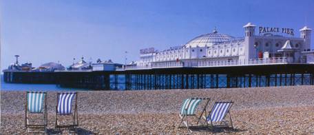
Brighton Jetty
A Brief History of Point
Turton and Point Souttar
by Steve Reynolds
Whilst Matthew
Flinders was exploring and charting Australia’s southern coastline in the
Investigator in1802 he discovered South Australia’s western gulf. After
exploring the gulf’s western shore to its northern limit, Flinders proceeded to
sail down its eastern shore.
On 17th
March 1802 Flinders passed a point which he named Point Pearce after “Mr Pearce
of the Admiralty”. Beyond the point, the Investigator sailed into a
large bay. Flinders spent much of the 18th March charting the
shoreline of the bay before sailing towards the next point south. He named this
Corny Point, the reason for which is not clear.
Having left the
bay between Point Pearce and Corny Point on 19th March, Flinders
named it Hardwicke Bay after the Right Honourable Charles Phillip Yorke of the
Admiralty in England. Yorke was the 3rd Earl of Hardwicke.
Flinders then
continued south beyond a cape which he named Cape Spencer after the Right
Honorable George John, First Lord Commissioner of the Admiralty in 1800. John
was the 2nd Earl of Spencer. He had approved Flinders’ plans to
explore and chart the Australian coastline.
Having left the
gulf on 20th March, Flinders named it Spencer’s Gulf after Lord
Spencer.
Flinders went on
to explore South Australia’s eastern gulf which he named Gulf of St Vincent
after Sir John Jervis who was the First Lord Commissioner of the Admiralty when
Flinders left on his voyage from England. Jervis was the Earl St Vincent.
Flinders named
Mount Lofty whilst he was sailing in the Gulf of St Vincent on 23rd
March 1802.
Flinders’ exploration
of Spencer’s Gulf and the Gulf of St Vincent led to the charting of the
peninsula between the two gulfs. On 30th March Flinders named the
peninsula Yorke Peninsula after the Right Honourable Charles Phillip Yorke of
the Admiralty.
In March 1830 HM
Colonial cutter Dart was sailing in Spencer Gulf, having been sent from
Sydney to SA by the NSW Government to trace the whereabouts of the explorer
Captain Charles Sturt.
Four years
later, in 1836, the first South Australian settlers arrived at Holdfast Bay,
Glenelg on the eastern shore of Gulf of St Vincent. The State’s capital was
established in the area named Adelaide after Queen Adelaide, the consort of
England’s King William IV.
John Hindmarsh
was SA’s first Governor in 1836. By 1862 SA had an Irish-born Governor in Sir
Dominick Daly. The Governor had two daughters, Joanna and Caroline. Both girls
had their wedding day on the same day. They both married bankers. Joanna
married John Souttar, Manager of the Bank of Adelaide. Caroline married HH
Turton, manager or accountant at the Savings Bank of SA, Adelaide.
Sir Dominick
Daly was the Governor until he died in Government Cottage at Glenelg on 19th
February 1868. John Souttar became Mayor of Glenelg in 1874.
A detailed
survey of Spencer’s Gulf was done by the Admiralty survey schooner Beatrice
under the command of Captain Hutchinson RN. Hutchinson named Point Souttar
after John Souttar and Point Turton after HH Turton.
Point Turton was
developed in the 1870s as a port for Warooka. A jetty was built there in 1876
at a cost of £2376. The government-owned jetty was 340 feet long and the depth
of the water was some 7½ feet.
The cliffs
behind the jetty were limestone and the stone would be shipped away from the
jetty. BHP mined flux there for the smelters at Port Pirie. Quarrying of the
limestone ceased in 1917. From then on the jetty could only serve the port of
the Warooka district. Grain, superphosphate, heavy freight and local provisions
were all loaded and unloaded at the jetty. This all ceased in the early 1960s.
Nearby
Flaherty’s Corner is named after an early pioneer family that lived there
previously. Their cottage sits at the foot of Warooka Hill on the
Warooka-Minlaton Road. It was the first cottage to be built in the area in
1860.
Twenty men spent
fifty weeks digging an eight-mile long drainage channel with picks and shovels
in the area in 1900. The channel is now known simply as “The Drain”.
On 29th
May 1926 the tug Yulta was stranded at Point Turton. The wooden tug was
the former mail steamer James Comrie which had been built in NSW in
1877. The steamer was converted into a 64-ton tug with the dimensions: - length
94 feet, beam (breadth) 18 feet and draught 8 feet. The remains of her boiler
can still be seen just south of the jetty at low tide.
“Yorke Peninsula
Shipping” by Ronald Parsons says that the James Comrie had been a wood
screw steamship of 101 gross tons. It seems that she may have been converted in
1909 without any real change of dimensions. She was towing barges to Port
Adelaide when she sprang a leak and was beached near Point Turton jetty. She
was abandoned there when found to be beyond economical repair.
The James
Comrie had been purchased by the Southern Yorke’s Peninsula S.S. Company in
1877 at a cost of £4000. The company later dropped the “Southern’ part of its
name to become the Yorke’s Peninsula Steamship Company. In 1833 the company
purchased the much larger (216 gross tons) SS Warooka for its gulf
services.
The floor and
walls of the old cliff quarries at Point Turton later became the site of a
caravan park. The jetty now serves only fishermen and divers.
REFERENCES:
“Nicolas Baudin’s Scientific Expedition To The Terres
Australes” by Steve Reynolds, MLSSA Journal No.12, December 2001.
“The
Encounter Continues” by Steve Reynolds, MLSSA Journal No.13, December 2003.
“My Continuing “Encounter” Experiences” by Steve
Reynolds, MLSSA Journal No.14, December 2004.
“After The Encounter” by Steve Reynolds, (7 parts)
MLSSA Newsletters Jan to July 2003.
“The Romance of Place Names of South Australia” by
Geoffrey H. Manning (1986).
“South Australian Geographical Journal”, Special
issue for Encounter 2002, Vol.99, 2000, Royal Geographical Society of South
Australia.
“Yorke Peninsula – A Resident’s Views” by Allan Parsons.
‘Mucking about at
Muston Jetty’
(Part 1 of 2)
by David Muirhead
Reputedly
the world’s smallest cephalopod, the Southern Pygmy Squid is very much at home
at American River, as I found when diving at Muston Jetty in the winter of ’05
and when snorkelling at American River Wharf this winter just gone.
The rather
unflattering scientific name Idiosepius notoides gives little clue as to
how cute these tiny squid can appear in their natural habitat.
As adults
generally attain lengths of barely 2 cm divers who’ve never seen one can readily
be excused.
.jpg)
Remains of Muston
Jetty
(Photo by Philip
Hall)
To
compound this invisibility to divers, they usually have subdued dark brownish
to yellowish colouration. However like
all cephalopods they can vary their colour and patterning to suit mood,
behaviour or habitat and very close viewing in low ambient light will often
reveal tiny pale blue spots over their drab bodies.
A
characteristic feature is the white star-like markings around the eyes, which
make the already small dark eyes even harder to discern.
Even when
viewing a sharp image one must concentrate hard to get the general idea of
which end is which.
And there
are other clever distractions of body contour and posture, some of which are
unusual even for a cephalopod, to further frustrate observers and especially
photographers.
They often
hold their already rather short and dense little clusters of arms in a
flattened and ‘squared-off’ posture which looks uncannily like the broken end
of a dead posidonia leaf.
Such drift
seagrass detritus of course usually has the same drab
.jpg)
Southern
Pygmy Squid at Muston jetty
(Photo by David
Muirhead)
yellowish
brown to almost black base colours as this squid, often overlaid with paler
white, cream, grey or pink speckles and blemishes from diminutive epiphytic
colonies of encrusting calcareous red algae, tiny worm tubes, molluscs or their
eggs, bryozoa and the like.
As if all
this was not enough to ensure cryptism, they characteristically adopt one of
several bodily profiles to suit the circumstances.
When venturing any distance into the water
column from their preferred demersal existence they usually form into a long
thin almost triangular dagger or dart-like shape making them hard to see when
without cover.
In stark contrast to this bodily form, when
returning to the bottom with it’s cover of invertebrates, rubble, seagrass and
algae they can then quickly ‘square-off’ their front and rear ends, perhaps aided by the prominence of the
special suction disc or adhesive gland on their rear upper body surface, giving
them an elongate rectangular profile when viewed from above.
I have no
doubt this evolutionary ploy is intended to mimic those innumerable shortish
broken segments of dead seagrass which abound everywhere in our calmer inshore
estuarine marine habitats – and it certainly worked with me, for I had the
Dickens of a time trying to see them through the lens well enough to focus
correctly!
These
critters are very inquisitive and never seem to move far away from sedentary
divers such as myself once sighted – but if you take your eye off one even for
a fleeting moment, chances are you’ll not be able to find the blighter again,
until he/she decides to ‘come into view’ perhaps several minutes later!
.jpg)
American River Jetty
(Photo by Philip
Hall)
More On Former River Boats In SA Waters
by Steve Reynolds
In my article
“Two Riverboats That Sank In SA’s Gulf’s” published in our March 2005
Newsletter (No. 319) I said that the PS Pevensey caught fire and burned
near Morgan in 1932. Only her hull, boiler, and engines remained. She had to be
rebuilt at the Morgan wharf.
The Pevensey
was a sister ship to the Ulonga and the Wanera. They were all
built on the Moama slipway near Echuca, NSW on the River Murray. The Permewan,
Wright & Co Ltd was the builder.
Actually, the Pevensey
was first built as a barge (like the Moorara) called the Mascot.
She was then converted into a paddle steamer and was powered by a Marshall
20-hp two-cylinder engine. She was then 111 feet in length and her beam was 23 feet.
She was 30 feet across the ‘sponsons’, platforms projecting from the ship’s
sides. Her paddlewheels were 14 feet in diameter and her paddlebox carried the
large red circle (spot?) of the Permewan, Wright & Co. A derrick crane was
fitted on to her foredeck a few years after her construction.
She was named
after a shearing shed. She was able to carry either 120 tons in her holds or 90
passengers. She featured in the film “All The Rivers Run” (based on the book by
Nancy Cato) as the Philadelphia.
The book
“Redgums and Paddlewheels - Australia’s inland river trade” by Peter J.
Phillips says that the metric sizes of the Pevensey were 34m X 7m X
1.4m. She is described as having a composite hull, paddlewheels on the sides
and a wood burning steam engine. She is said to be kept at the Echuca wharf.
When the Pevensey
caught fire and burned near Morgan, she had to be rebuilt on the wharf there.
As mentioned in my article “Two Riverboats That Sank In SA’s Gulf’s”, cabins
from the PS Decoy, which was being dismantled at the time, were
transferred to the deck of the Pevensey.
It seems that
the Decoy may have been built (or registered) in Fremantle, WA because,
as my article said, the words “Decoy – Fremantle” can still be seen on the
rear-cabin front wall now fixed on to the Pevensey.
My article also
mentioned a possible link between the Decoy and the Moorara (as
well as the Pevensey). That ‘link’ is closer than I had imagined. Both
the Decoy and the Moorara were pictured together on page 134 of
the book “Redgums and Paddlewheels”. I didn’t know what had become of the Decoy.
I didn’t know why she was being dismantled in 1932.
.jpg)
The Decoy
as a house at the Mannum Boat Haven and Slipway
(Photo by Steve
Reynolds)
She still exists
and I have now tracked her down. She has become a family home and is located at
the Mannum Boat Haven and Slipway on Purnong Road at North Mannum. This is how
she came to be there: -
The Decoy
was built by Henderson and Co. in Dumbarton, Scotland. She was first registered
in 1878. She was apparently shipped in pieces to Melbourne, Australia. When she
was rebuilt, she worked on inland rivers, including the Swan River in Perth,
WA. She went on to become a passenger vessel on the Swan River. At some stage,
she came (returned?) to SA where she was used in building locks and weirs. She
was then converted in to a house by a Mr Brand in the 1930s. This explains why
she was being dismantled back in 1932. At some stage after this she was used as
a house at Paringa, near Renmark. Her present owners, Dick and Wendy, purchased
her for themselves about 1984. They towed her down river behind the Amphibious
to the Mannum Boat Haven. She was moored there to become the family home. Her
new owners filled the hull with concrete and wire to preserve her at the water’s
edge.
I am presuming
that the Amphibious is the same one listed in “Ketches of South
Australia” by Ronald Parsons i.e. the one iron-hulled, registered in Port
Adelaide in 1877 and intended for trading on the River Murray. She was acquired
by R.Fricker in 1904 and converted into a ketch. The hull was later timbered
over and she became a composite vessel. She was under the later ownership of
R.Fricker and AC (Albert?) Cutler about this time. In 1956, under new
ownership, two motor engines were installed. She was then converted into a
showboat for use on the Port River. She was laid up and sold after that.
Parsons said that it had “been suggested that the vessel may be refitted to
return to the Murray”.
The book “A
Cruising Guide to Historic Gulf Ports – Volume 1” by Graham Scarce says that
the Amphibious was “One of the more noteworthy vessels of (her) era”
saying that she “started life as a 49 ton freight barge carrying general cargo
along the River Murray. Built in 1875 as a steel hulled, twin screw vessel, she
was subsequently converted into a wooden planked ketch of 40 tons; to be the
focal point of a show boat enterprise sailing along the Port River. The
commercial venture did not prove successful and so she was laid up, but sprang
a leak and sank at her moorings. When salvaged, she returned to a mundane
service life, but the undoubted highlight of her long life was when she was
used in the film Gallipoli by the South Australian Film Corporation”.
Dick is a very
knowledgeable man. He was able to tell me the history of the Decoy,
including where her engine was ‘dropped’ and how she was lengthened at some
stage. We discussed both the Ulonga and the Moorara. Dick told me
that he was almost on the Ulonga for her final voyage before she sank
off of Carrickalinga Beach, near Normanville in 1976. He certainly knew of her
Captain, Albert Cutler. He, and Cutler’s niece, have both made it clear to me
that Cutler did not use the name Albert. He was ‘Skug’ Cutler to everyone that
knew him well (Uncle Skug to his niece).
Skug and all of
his crew escaped from the sinking Ulonga in a raft. They were picked up
and taken safely to Port. Some cattle are said to have drowned though. Skug’s
niece tells me that he was such a sweetheart and that he “had a hard time
getting over watching the cattle swim around in circles that (fateful) night”.
She recalls how both her mum and her aunt (Skug’s wife?) waited for his safe
return home.
But I seem to be
getting off of the track. Dick recalled the sinking of the Moorara at
Wardang Island in 1975. He had wanted to salvage her but the Government of the
time refused to give him permission until five years later when he said that it
was too late. According to “Wardang Island Maritime Heritage Trail”, the masts
and rigging were salvaged from the Moorara.
REFERENCES:
“Two Riverboats
That Sank In SA’s Gulf’s” By Steve Reynolds, MLSSA Newsletter, March 2005 (No.
319).
“Redgums and
Paddlewheels - Australia’s inland river trade” by Peter J. Phillips, Greenhouse
Publications P/L, 1980. ISBN 909104 26 3.
“Wardang Island
Maritime Heritage Trail” published by the State Heritage Branch of the
Department of Environment and Planning, 1991. ISBN 0 7243 8629 7.
“Ketches of
South Australia” by Ronald Parsons, July 1978.
“A Cruising Guide to Historic Gulf Ports – Volume
1” by Graham Scarce, 1985, Kingsley Publications. ISBN 0-9589703-2-7.
by Adrian Brown
Often
life’s a puzzle, throwing us little pieces of a much larger picture, but seldom
offering an answer. So it has been with
the recent spate of seahorse dieoffs occurring on the beaches of the Lower
Yorke Peninsula, along some hundred kilometres of coastline, from Stenhouse Bay
in the South to Port Moorowie in the north.
The first pieces of the puzzle arrived at my feet at the beginning of
June this year, when over a long weekend I collected 75 specimens from amongst
the sea-wrack left by a falling morning tide.
All but nine came from the beach that lies near the wreck of the
Willyama, the remainder came from below Hillock Point, some 8.5 km to the
north. It was with this that the extent
of the event first became apparent.
A second
event occurred in similar fashion when I found myself walking the same short
stretch of beach some four weeks later.
On this occasion there were 300 of these diminutive creatures scattered
evenly along the beach. All were fresh
with some still showing signs of life.
Coupled with this were widespread reports, taken up by the media, of
thousands of seahorses washing up along the shoreline at Foul Bay, 20 to 30 kilometres
to the north of the Marion Bay township.
In the
time between these two events the first seahorses had been taken to the South
Australian Museum where problems with identification became apparent. They
weren’t keying out to any of the possible species of Hippocampus that are
expected for South Australia. This
coupled with the confused state of the taxonomic identification of the genus
here means their identity still remains a mystery.
Museum
records show that we could expect to see either Hippocampus breviceps (Short-headed
Seahorse) or maybe H. whitei (Whites Seahorse). Another complication was the appearance of a
species named H. novaehollandiae (New Holland Seahorse) which had been
described in the mid nineteenth century, but later found to be a synonym of H.
whitei. Several of the specimens in
the SA Museum’s collection were labelled as H. novaehollandiae,
including a group collected at Corny Point in 1912.
Keying out
the collected specimens has ruled out H. whitei or H. breviceps. H. abdomalis, the much larger and quite
distinctive Pot-bellied Seahorse, is also not a candidate, leaving us
struggling for a known species for identification. It may be that the answer lies in a species
found in Western Australia, although this has not been checked yet.
Meanwhile
more parts of a much larger puzzle started to appear, often in the form of
anecdotal evidence tendered by people who became interested in the story and
had a memory sparked. Earlier this year
there were reports of many seahorses from as far north as Port Moorowie, where
specimens were collected by PIRSA for pathological testing. Also in the middle of March many more
seahorses were ashore in Foul Bay, almost certainly in the northern part of the
bay closer to Sturt Bay. Within Innes National
Park there have been a number found at Emu Beach, just north of Stenhouse Bay
Jetty. There is no real answer to the
die-off, which can not be immediately linked to any natural or anthropogenic
cause. Significantly there seems to be
no recorded precedent worldwide for an occurrence such as this.
What we see is quite
widespread and there is no answer yet to suggest a cause for an event of such
scope, amongst a single species. If
anyone reading this article has any experience of similar events, either
current or historical, we would appreciate hearing from them. I can be
contacted at adrian.brown@ozemail.com.au
or alternatively you could contact Robert Browne at robert.browne@gmail.com.
Comment On Pt Jackson
Shark Aggregations
by Scoresby Shepherd
In late 1964,
Professor Geoff Satchell at Adelaide University was studying the physiology of
Pt Jackson sharks, and he asked for a supply of them, so with friends, I
undertook searches for several months. In December of that year, on a dive at
Pt Noarlunga, inshore of the reef we found a very large number. I had with me a
10 m line, so, in the interests of efficiency, I tied a loop round the tail of
one, then caught the next and tied it to the same line, about one metre away
from the first, and so eventually caught about ten, and tied them to the line,
each about a metre apart. By this time the sharks were getting agitated, and
one or two became aggressive. Then they all started swimming frantically
in different directions. In no time I found myself in a tangled mass of
snapping sharks, and line. My mask and mouthpiece were caught up and dragged
off, and I desperately made for the surface, along with a seething mass of
sharks. Luckily a friend saw my plight and together we got the sharks ashore.
They gave their lives for science, but happily I didn’t.
We have since
learned that these sharks aggregate annually at about this time of year to lay
their eggs, and then migrate to the south, but where they go from Gulf St
Vincent is still a mystery. In NSW a large number of the same species were
tagged, and it was found that they migrated several hundred km south to eastern
Victoria, returning year after year at the same time to the same reefs to lay
their eggs. Apparently these sharks have a well-developed spatial memory,
enabling them to return to their home sites, and even the same crevices on the
same reefs with unerring accuracy. They aren’t so stupid after all !